Regulation 19 consultation · extended to 10 November 2026
How to object to Lower Langdon.
5,000 homes below Langdon Ridge Site of Special Scientific Interest
Download the guide (PDF) The PDF was written for the original 14 October deadline. The deadline is now midnight on Tuesday 10 November 2026.
Lower Langdon and Corringham Park Farm: a guide to responding to Thurrock Council's Regulation 19 Local Plan consultation
New deadline: midnight on Tuesday 10 November 2026. The Council has extended the consultation. Please send yours by Friday 6 November so nothing is lost at the last minute.
Why it was extended. The Council found an error in its Habitats Regulations Assessment, the document that checks whether the plan could harm protected wildlife sites. The version it published had not assessed Lower Langdon at all, as our representation showed. The Council published a replacement on 20 October. It adds a few lines on Lower Langdon and changes none of the assessment’s conclusions. Natural England, the government’s adviser on nature, says Policy SS18 as drafted is “not legally compliant with the Habitats Regulations and unsound”.
Already commented? If you commented before 14 October, your comment stands and you do not need to send it again. You can send a new comment, for example on the updated assessment, if you wish.
Allow about an hour. Doing this properly takes around an hour: reading this guide, choosing your points and writing them in your own words. It is best done on a computer or laptop, not a phone, because the Council's online form and the plan documents are hard to use on a small screen.
About this guide
Thurrock Council's new Local Plan proposes a new town of 5,000 homes, called Lower Langdon, on the Green Belt fields between Stanford-le-Hope, Corringham and Langdon Hills. It is Policy SS18 in the plan. The land borders the Langdon Ridge Site of Special Scientific Interest (SSSI) and the fields that keep our developed communities apart.
The plan is now at its final public consultation, known as "Regulation 19". This is the last chance for residents to comment before an independent Planning Inspector examines the plan, expected in 2027. The Council must pass every comment to the Inspector with the plan. The Inspector can recommend that a policy is deleted if it fails the legal tests, and that is what we are asking for.
This guide explains how to write and send your own objection. It covers:
what the Inspector is looking for, in plain English;
the three ways to send your objection: online, by email or by post;
how to fill in each question on the Council's form, with worked examples;
a menu of 50 problems with Policy SS18, drawn from the Council's own documents, for you to choose from.
You do not need to be an expert, and you do not need to use every point. A short response in your own words, making a few clear points, is worth sending. If you want to raise an issue that is not covered in the menu, email protectlangdon@gmail.com and we will weigh it against the evidence and try to help you frame it against the legal tests.
The work behind this guide
Since the plan was published we have gone through the Council's evidence line by line: 77 documents and nearly 10,000 pages. We have run more than 25 independent analyses and logged 160 defects in the Council's case for SS18.
The points in this guide are the ones anyone can check in the Council's own published documents. Our full representation, on behalf of Protect Langdon, was filed on 14 October 2026. It runs to more than 340 pages in two volumes and sets out the complete legal and technical case for deleting Policy SS18. Read it in full.
Dr Jackie Lighten (lead) will ask to speak in person at the examination hearings on behalf of Protect Langdon.
The short version (full instructions below)
The consultation now closes at midnight on Tuesday 10 November 2026. Please send yours by Friday 6 November if possible.
You must give your name and address. Anonymous comments are not considered. Your name will be published with your comment.
Object to Policy SS18 and say what you want: delete Policy SS18 and keep the land in the Green Belt.
Pick five to ten points from the menu below that matter most to you, and write them in your own words. Add what you know from living here.
Please do not copy and paste the whole list as your response. The Inspector weighs arguments, not numbers of identical letters. Two hundred different responses, each making its own points, are far harder to set aside than two thousand copies of one.
What the Inspector is looking for
The Inspector does not decide whether the new town is popular. The Inspector asks two questions, and your objection should answer both.
Question 1: Is the plan legally compliant?
This is about the process. Did the Council follow the law and regulations when it prepared the plan? For example: did it consult people properly, and in the way its own consultation rules promise? Did it carry out the assessments the law requires? The Inspector must find the plan legally compliant before it can be adopted.
Question 2: Is the plan sound?
This is about substance. National policy sets four tests, and a plan must pass all four. In plain English:
| Test | The plan passes if... | It fails if... |
|---|---|---|
| Positively prepared | it meets the area's real needs in a sensible, sustainable way | it plans for more than is needed, in the wrong place, or at the wrong time |
| Justified | it is backed by proper evidence and is the best option compared with the alternatives | the evidence is missing, contradicts itself, or points the other way |
| Effective | it can actually be delivered within the plan period | there is no money, no infrastructure, or no realistic way to build it |
| Consistent with national policy | it follows the National Planning Policy Framework (NPPF), the Government's planning rules | it goes against them, for example on Green Belt, wildlife sites or flood risk |
How the menu uses these tests. Every point in the menu ends with "Fails:" and the test or tests it shows the plan failing. Use that in your own words, for example: "Because there is no wildlife survey, Policy SS18 is not justified." Each point also gives its source in the Council's own documents for you to cite.
Complaints about views, traffic on your road or house prices on their own will not carry weight. The same worries do carry weight when you link them to a test: "the Council has no evidence that...", "this cannot be delivered because...".
Three ways to send your objection
Whichever way you choose, answer the same eight questions as the Council's official form. The worked examples in the next section ("Filling in the form, question by question") apply to all three: online form, email or post.
Option 1. Online web form, using Place Maker (the Council's preferred way)
Go to the Council's Regulation 19 page (link below) and click "Comment on the Local Plan".
www.thurrock.gov.uk/new-local-plan-for-thurrock/local-plan-regulation-19-consultation
Click "Log in" at the top of the page. If this is your first time, click "Register", enter your name, email address and a password, then click the link in the confirmation email to activate your account.
Find Policy SS18: press Ctrl and F on your keyboard and search for "SS18". Or scroll to the bottom of section "5. Places and Site Allocations" and click the link to Policy SS18.

Click the green speech bubble with a plus sign to the right of the policy heading (these appear throughout the plan and all open the same form). This opens the representation form.

The form opens with your personal details already filled in (questions 1 and 2). Complete questions 3 to 8 using the next section below, "Filling in the form, question by question".
Click "Submit". You will see a confirmation message. Each comment is submitted on its own, and you can download a PDF of everything you have sent from "My Responses" in your account. Keep a copy.
Option 2. By email
Send to reg19localplan@thurrock.gov.uk
Subject line: "Regulation 19 representation: objection to Policy SS18"
Set your email out under the same eight numbered headings as the online form, so the Council can log it correctly and pass it to the Inspector in the right place:
1. Personal details: your full name, postal address and email address.
2. Agent's details: write "None" (unless someone is writing on your behalf).
3. Which part of the Local Plan: "Policy SS18: New settlement north of the A13 (Lower Langdon and Corringham Park Farm)".
4. Do you consider the Local Plan is (1) Legally compliant: No. (2) Sound: No.
5. Why the Local Plan is not legally compliant or is unsound.
6. The modification(s) needed, and why each would make the plan legally compliant and sound.
7. Whether you wish to take part in the examination hearings: Yes or No.
8. If yes, why you wish to take part (or the Protect Langdon support line: see question 8 below).
Use the worked examples in the next section for questions 5 to 8, in your own words.
End with: "Please notify me when the plan is submitted for examination, when the Inspector's report is published, and when the plan is adopted."
Option 3. By post
Address: Reg 19 Representations, Strategic Planning, Thurrock Council, Civic Offices, New Road, Grays, RM17 6SL
Paper copies of the official form are available at every Thurrock library. If you use the paper form, answer each numbered question in the box provided.
If you write a letter instead, set it out under the same eight numbered headings as the online form (listed under Option 2 above), and add the same notification request at the end.
Allow at least four working days. Post by Wednesday 4 November, or hand it in at the Civic Offices.
Filling in the form, question by question
These are the questions on the Council's official form. Online, questions 1 and 2 are filled in for you. By email or post, answer all eight under the same numbers.
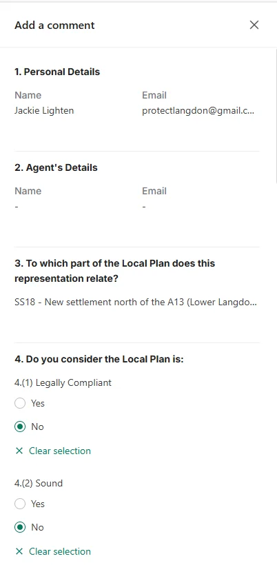
Questions 1 and 2: your details
Your name, address and email. Online, the agent section is filled in from the profile you create when you register (for example, as a resident, a company or a group), so you can leave it. By email or post, write "None" for the agent unless someone is responding for you. Your name will be published; anonymous responses are not considered.
Question 3: which part of the plan
"Policy SS18: New settlement north of the A13 (Lower Langdon and Corringham Park Farm)".
Online, this is filled in for you when you click the speech bubble next to the policy.
Question 4: legally compliant and sound?
Select "No" for 4(1) Legally Compliant and "No" for 4(2) Sound.
The points in this guide are about soundness. Protect Langdon's full representation sets out the legal compliance failures in detail, and you can rely on it: the example for question 5 shows how.
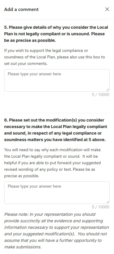
Questions 5 and 6 on Place Maker (up to 10,000 characters each)
Please read before using the examples. The examples below show how a response can be set out. They are not a letter to copy. Please rewrite them in your own words and choose your own points from the menu below, adding anything you know from living here. This matters because identical responses carry less weight: the Inspector weighs the arguments made, not the number of copies received. Text in [square brackets] is where your own details go.
The form also warns that you should give all your evidence now, because you may not get another chance. So for each point, name the Council document it comes from.
Question 5: why the plan is not legally compliant or is unsound
I object to Policy SS18 (Lower Langdon). I consider it unsound because it is not justified, not effective and not consistent with national policy. On legal compliance, I support the representation made by Protect Langdon.
[About me: I have lived in ... for ... years. I walk in Langdon Hills ... / my children go to school in ... / I commute by train from ...]
1. The Council's own Green Belt evidence rejected this land. The Stage 2 Green Belt Assessment (Appendix 4.5, sub-area CS-01, PDF pages 4 to 6) scores the land 5 out of 5 for preventing towns merging, says it is "Not recommended for further consideration in isolation", and records it as "No" for the ‘provisional grey belt?’ question. The plan gives no reasons for overruling its own consultant. National policy allows Green Belt to be released only in exceptional circumstances, and none have been shown. The policy is not justified and not consistent with national policy.
Fails: justified; consistent with national policy.
Source: Stage 2 Green Belt Assessment, Appendix 4.5 Corringham and Stanford-le-Hope (Arup, February 2026), sub-area CS-01, PDF pages 4 to 6.2. There is no wildlife survey of any kind. The site borders Langdon Ridge Site of Special Scientific Interest (SSSI) and lies inside Natural England's Impact Risk Zone for it. The Council's own appraisal admits that effects on wildlife "cannot be determined at this strategic level of assessment" (Integrated Impact Assessment Appendices, PDF page 209). National policy gives SSSIs the highest protection. Allocating the land without knowing the effects is not justified. The land which SS18 intends to build on houses breeding populations of Red List and protected birds, reptiles, mammals and invertebrates. None are considered by the Local Plan.
Fails: justified; consistent with national policy.
Source: Integrated Impact Assessment Appendices (July 2026), Appendix D, PDF page 209; Natural England Impact Risk Zones (MAGIC map); Natural England, Langdon Ridge SSSI supporting information (notified 29 June 2019); Protect Langdon field records.3. There is no flood model. The Level 2 Strategic Flood Risk Assessment (February 2026) is marked "not yet approved for issue". For this site it says "detailed modelling should be undertaken". None has been. Langdon Ridge is the highest ground in south Essex, and its slopes drain across the proposed building site towards Stanford-le-Hope. The Council's consultants set aside only 4 per cent of the developable land, about 6.4 hectares, for drainage, with no calculation showing it can hold back the storm water from a site of this size (Lower Langdon Site Specific Assessment, PDF pages 24 to 25). The Council's own 2023 plan document says surface water run-off from the south-western corner of the site "affects flooding in" Stanford-le-Hope (Initial Proposals, PDF page 152). [Your own experience, for example: my road flooded in ...] The policy is not justified.
Fails: justified; effective.
Source: Level 2 Strategic Flood Risk Assessment (AECOM, February 2026, draft), quality page and site table entry ACM_071 (site 60940); Transport Assessment: Lower Langdon Site Specific Assessment (Arup, July 2026), PDF pages 24 to 25; Local Plan Initial Proposals (December 2023), PDF page 152; Environment Agency long-term flood risk map (surface water).4. The infrastructure is not planned or funded. The Infrastructure Delivery Plan (July 2026) refers to "the proposed new 4,000 homes at Lower Langdon", not 5,000 (PDF page 165). It says GP capacity is "not available in any of the PCN areas" (PDF page 123). It describes Basildon Hospital as rated "good" in 2019 (PDF page 118), yet the Care Quality Commission rated it inadequate in October 2025. [Your own experience, for example: I waited ... weeks for a GP appointment.] The policy is not effective.
Fails: effective; justified.
Source: Infrastructure Delivery Plan (Arup, July 2026), PDF pages 118, 123 and 165; Care Quality Commission report on Basildon University Hospital, October 2025.5. The number was set before the evidence. The Council's consultants set out their capacity method stating that the figure "must demonstrate capacity exceeding the 4,000-dwelling target" (Lower Langdon Site Specific Assessment, PDF page 24). A study told what to find cannot justify the allocation.
Fails: justified.
Source: Transport Assessment: Lower Langdon Site Specific Assessment (Arup, July 2026), PDF page 24.6. The landscape cannot take a new town. The Council's Landscape Sensitivity and Capacity Analysis rates the Langdon Lower Hill Slopes, where part of the site lies, as having "very high" susceptibility to a new settlement of over 3,000 homes, because it "would take up a substantial part of the LCA [Landscape Character Area] and erode the rural character of the area" (Table 48, PDF page 113). The policy does not mention this finding. [Your own experience, for example: the view from ... across these fields.] The policy is not justified.
Fails: justified; consistent with national policy.
Source: Landscape Sensitivity and Capacity Analysis (May 2026), Table 48, Landscape Character Area J1, Langdon Lower Hill Slopes, PDF page 113.For these reasons Policy SS18 is unsound and should be deleted.
Optional closing line for question 5. Protect Langdon's full representation sets out the complete evidence, with page references. You can bring that evidence into your own response by adding: "I also rely on the evidence set out in the representation that will be made by Protect Langdon."
Question 6: the modification needed, and why it makes the plan sound
You do not need to cover all four soundness tests. Each problem in the menu lists the tests it fails, so use those to explain why removing SS18 makes the rest of the Local Plan sound. The example below shows all four so you can pick the ones that match your points.
Modification sought: Delete Policy SS18 (Lower Langdon) and its supporting text in full. On the Policies Map, remove the SS18 allocation and keep the land in the Green Belt, with the boundary as it is today. Remove SS18 from the housing trajectory and the Infrastructure Delivery Plan.
Why this makes the plan sound [include only the tests that match the points you made in question 5]:
Justified: the plan would no longer rely on land that its own Green Belt, housing land and heritage evidence recommended against, or on a site with no wildlife survey and no flood model.
Consistent with national policy: Green Belt that stops Corringham and Stanford-le-Hope merging with Basildon would be kept. So would the setting of Langdon Ridge Site of Special Scientific Interest (SSSI), which national policy protects.
Effective: it removes an allocation the Council cannot show will be delivered. Its own viability study records that discussions with the promoter "have since stalled" and that no homes are expected "in the first 5 years of the plan". Much of the infrastructure the site needs is not costed, designed, scoped or funded.
Positively prepared: the Council's housing study says its higher housing target "would not be necessary" for baseline growth, and SS18 would deliver only about 600 homes by 2034.
Why a smaller allocation would not work: reducing the number of homes would not make SS18 sound. The land would still be Green Belt the Council's own consultants recommended against, still beside the SSSI, and still without a survey, a flood model or funded infrastructure. Deletion is the only change that makes the plan sound.
Questions 7 and 8: taking part in the hearings
Question 7 asks whether you want to take part in the examination hearings. You have two good options.
If you want to speak for yourself at the public examination, answer "Yes". Anyone who asks for the plan to be changed has the right to ask to be heard. The Inspector decides how the hearings are run and may group people with similar views. At question 8, say why, for example:
I wish to take part because I live [near the site / in Stanford-le-Hope / etc.] and can give first-hand evidence on [flooding / the roads / access to GPs / the wildlife on the SSSI edge] that is not in the Council's evidence.
If you would rather not speak, you can let Protect Langdon speak for you. At question 8, add:
I support the representation made by Protect Langdon and am content for Protect Langdon to represent my views at the examination hearings.
If you tick "No" at question 7 and question 8 does not appear, add the Protect Langdon line at the end of your answer to question 5 instead.
Inspectors welcome a single, well-prepared spokesperson for people who share the same concerns. Each supporter who names Protect Langdon shows the Inspector how many residents stand behind that case. The hearings are also open to the public, so anyone can go and watch. Protect Langdon's representative, Jackie Lighten, will be well prepared to test the legal compliance and soundness of Policy SS18, and of the wider Local Plan, at the public examination.
Sentence starters
"The Council's own evidence says..."
"The Council has not produced any evidence that..."
"This makes the policy unjustified because..."
"Without this, the policy cannot be delivered, so it is not effective."
"This is contrary to national policy, which requires..."
"As someone who lives in..., I know that..."
"I ask the Inspector to delete Policy SS18."
The menu: 50 points
Choose the ones that matter to you. Each point comes from a published document and has a source line under it, so you can name the document and page in your own response. The form asks you to give all your evidence now, so it is worth including the source for each point you use.
All of the Council's evidence documents are on its Local Plan Technical Evidence page: www.thurrock.gov.uk/localplanevidence. Page numbers are PDF page numbers: the number your PDF viewer shows, which can differ slightly from the number printed at the foot of the page.
A. The Council's own experts said no
The Green Belt study rejected this land. The Council's Stage 2 Green Belt Assessment scores the land 5 out of 5 for preventing towns merging and says it is "Not recommended for further consideration in isolation". Fails: justified; consistent with national policy.
Source: Stage 2 Green Belt Assessment, Appendix 4.5 Corringham and Stanford-le-Hope (Arup, February 2026), sub-area CS-01, PDF pages 4 to 6.
The Green Belt study said the towns would merge. The same study says development here "would lead to the physical merging of neighbouring towns": Corringham and Stanford-le-Hope with Basildon. Preventing towns merging is one of the Green Belt's core purposes in national policy. Fails: consistent with national policy.
Source: Stage 2 Green Belt Assessment, Appendix 4.5 Corringham and Stanford-le-Hope (Arup, February 2026), sub-area CS-01, PDF page 4.
It is not "grey belt". The study answers "No" to whether the land is provisional grey belt, because it scores strongly against the Green Belt's purposes. It is full, valuable Green Belt doing its job. Fails: consistent with national policy.
Source: Stage 2 Green Belt Assessment, Appendix 4.5 Corringham and Stanford-le-Hope (Arup, February 2026), sub-area CS-01, PDF page 6.
No new defensible boundary. The study says that if the land were released, the new Green Belt boundary "would not meet the NPPF definition" of a strong, permanent boundary. Fails: consistent with national policy.
Source: Stage 2 Green Belt Assessment, Appendix 4.5 Corringham and Stanford-le-Hope (Arup, February 2026), sub-area CS-01, PDF page 6.
No reasons for overruling the experts. The plan does not record why it overruled its own Green Belt consultant. National policy requires exceptional circumstances to be shown, not assumed. Fails: justified.
Source: Regulation 19 Local Plan (August 2026), Policy SS18 and supporting text, PDF pages 288 to 295; Stage 2 Green Belt Assessment, Appendix 4.5 Corringham and Stanford-le-Hope (Arup, February 2026), sub-area CS-01.
The housing land study called part of it unsuitable. In October 2025 the Housing Land Availability Assessment found Corringham Park Farm (site 60893) unsuitable because it "is located separate from existing settlements and is not of sufficient scale to form a standalone settlement". Ten months later it became the first phase of the new town. Yet it is still a separate site, divided from Lower Langdon by One Tree Hill, so the reason it was found unsuitable still applies. Nothing explains the change. Fails: justified.
Source: Housing Land Availability Assessment Appendices 2 to 4 (October 2025), Appendix 3, site 60893, PDF page 7; the Council's site boundaries for sites 60893 and 60940 (Place Maker).
The Council dropped the site, then brought it back. The Council's appraisal says its first preferred strategy "did not take forward Lower Langdon". The site was brought back later because of a higher housing number, which the Council chose to adopt above the Government's minimum, not because anything about the land had changed, and not because it was needed: the Council's own housing study says the higher target "would not be necessary" for baseline growth. Fails: justified.
Source: Integrated Impact Assessment (July 2026), paragraph 2.61, PDF page 51; Housing Needs Assessment (Turley, June 2025), paragraph 4.9, PDF page 31.
The Council's appraisal says the land keeps the towns apart. The appraisal says this land "prevents Stanford le Hope and Langdon from merging into one another", and records significant negative effects for landscape and flood risk. Fails: justified.
Source: Integrated Impact Assessment Appendices (July 2026), paragraphs G.299 and G.302, PDF page 439.
The two-town strategy ranked fifth of six. In 2023 the Council compared six ways of planning for new homes. The option with two new towns, West Horndon (7,000 homes) and Lower Langdon (4,000 homes), ranked fifth of six. The option that ranked first, and was chosen by the Council at that time, put most new homes in and around existing towns. The Council called it "the most sustainable option for growth", but the plan it has now published is built around two new towns instead, the approach its own appraisal had ranked near the bottom. Fails: justified.
Source: Integrated Impact Assessment of the Initial Proposals (LUC, November 2023), paragraphs 4.90 to 4.91 and Table 4.2.
Heritage harm the Council says to avoid. The Council's Heritage Impact Assessment rates the site "Moderate Adverse", a level of harm that "should be avoided". It points to four listed buildings near the western edge, including Arden Hall, and to the setting of the Horndon on the Hill Conservation Area. The plan answers only that there are no heritage assets inside the site, which misses the point: the harm is to their setting. Fails: justified; consistent with national policy.
Source: Heritage Impact Assessment, Housing Sites (February 2026), row for site 60940; Regulation 19 Local Plan (August 2026), paragraph 5.6.35, PDF page 295.
A landscape the Council's own study says cannot take a new town. Part of the site lies in the "Langdon Lower Hill Slopes" landscape area. The Council's Landscape Sensitivity and Capacity Analysis rates its susceptibility to a new settlement of over 3,000 homes as "very high", because such a settlement "would take up a substantial part of the LCA [Landscape Character Area] and erode the rural character of the area". The policy does not mention this finding. Fails: justified; consistent with national policy.
Source: Landscape Sensitivity and Capacity Analysis (May 2026), Table 48, Landscape Character Area J1, Langdon Lower Hill Slopes, PDF page 113; Integrated Impact Assessment Appendices (July 2026), paragraph G.302, PDF page 439.
B. The number of homes was set before the evidence showed what was achievable
The capacity study was told the answer to reach. The Council's consultants set out their method stating that the housing figure "must demonstrate capacity exceeding the 4,000-dwelling target". A study told what to find is not evidence. Fails: justified.
Source: Transport Assessment: Lower Langdon Site Specific Assessment (Arup, July 2026), PDF page 24.
The land was assumed to be developable. The same study treats the land as developable because it had been "identified by TC" (Thurrock Council), not because it was tested. Fails: justified.
Source: Transport Assessment: Lower Langdon Site Specific Assessment (Arup, July 2026), PDF page 22.
Corringham Park Farm is inflated. The consultants' own best-practice figure for Corringham Park Farm is 463 homes. The plan ignores this and applies 1,000 homes, an approach the consultants say "falls below best-practice standards". Fails: justified; effective.
Source: Transport Assessment: Lower Langdon Site Specific Assessment (Arup, July 2026), Table 5-8, PDF page 25.
Still speculative, four years on. Notes from the Council's 2022 design workshop at Horndon on the Hill say the land north of the A13 had "been submitted speculatively, no assessments have been done on it yet". Four years later the basic site assessments are still missing: there is no wildlife survey, no flood model and no drainage strategy (points 17, 31 and 36). Fails: justified.
Source: Horndon on the Hill charrette report (2022), PDF page 44.
The target needs a building rate never achieved. The Government's standard method sets Thurrock a minimum of 21,480 homes. The Council chose a higher target of 28,880, which means about 1,444 homes a year. Its own housing study says that is "nearly a fifth (19%) more than have been delivered in any single year since at least 2001". SS18 was brought back to help meet that higher, self-chosen target. Fails: effective; justified.
Source: Housing Needs Assessment (Turley, June 2025), paragraph 4.15, PDF pages 33 to 34; Regulation 19 Local Plan (August 2026), paragraph 4.2.2, PDF page 34; Integrated Impact Assessment (July 2026), paragraph 2.61, PDF page 51.
C. Wildlife and the Langdon Ridge SSSI
No wildlife survey of any kind. There is no habitat, bird, bat, newt, reptile, invertebrate, plant or tree survey for the site in the Council's evidence. This cannot be left until a planning application. Once the land is released from the Green Belt, the principle of building on it is settled. Releasing Green Belt next to an SSSI, inside its Impact Risk Zone, without knowing which rare and Red List species depend on it is not justified, and no exceptional circumstance outweighs the need to know that first. Fails: justified; consistent with national policy.
Source: The Council's published evidence base (no ecological survey is listed).
The Council admits it does not know what species are present. Its appraisal says the impacts on wildlife on each site "cannot be determined at this strategic level of assessment" and leaves them to a later planning application. The information exists: Natural England's own records describe the species along the SSSI boundary, and local residents and naturalists hold records of protected species on the fields and in the woods. The Council did not gather any of it. You cannot allocate protected and important Green Belt habitat and look later. Fails: justified; consistent with national policy.
Source: Integrated Impact Assessment Appendices (July 2026), Appendix D, PDF page 209.
It borders a Site of Special Scientific Interest (SSSI). The site touches Langdon Ridge SSSI and lies inside Natural England's Impact Risk Zone for it. National policy gives SSSIs the highest protection. Yet the Council's site selection counted an SSSI only as land to be cut out of a site. Land next to an SSSI, or inside its Impact Risk Zone, carried no penalty at all: the method never mentions Impact Risk Zones, and neither does the plan. Fails: consistent with national policy.
Source: Natural England Impact Risk Zones (MAGIC map); Site Selection Methodology (July 2026), section 3.2.1 and Table 2, PDF page 9; Regulation 19 Local Plan (August 2026).
Natural England's warning was not acted on. At the last consultation Natural England raised "significant concerns" that the site would cause "damaging recreational pressures on the Langdon Ridge SSSI which may be difficult to mitigate". It said the site "should not be taken forward until alternative site options have been fully considered", and that further assessment was needed if it was. The Council noted the advice, then took the site forward regardless. No further assessment of the effects on the SSSI has been published. Fails: justified; consistent with national policy.
Source: Regulation 18 Consultation Report (2026), Natural England comment IP0179 and the Council's response, PDF page 134.
Visitor pressure is already recorded. Natural England has recorded recreational disturbance as a pressure on the SSSI since 12 September 2019. The new town would add about 12,000 people next door, with no visitor study. Nor is there any assessment of the pet cats that 5,000 homes would bring, which hunt birds, reptiles and small mammals in the fields and woods. Fails: justified; effective.
Source: Natural England, Designated Sites View, Langdon Ridge SSSI.
The SSSI is still recovering. About 80 per cent of the SSSI is in "unfavourable recovering" condition. More pressure works against its recovery. Fails: consistent with national policy.
Source: Natural England, Designated Sites View, Langdon Ridge SSSI condition summary.
Declining birds. Natural England's records for the SSSI include nightingale, turtle dove and lesser spotted woodpecker, all on the UK Red List. Local records add barn owl, woodcock and skylark on the fields, and lesser spotted woodpecker in Fell-me-down Shaw, a strip of woodland inside the building area, cut off from the SSSI. None was surveyed by the Council. Fails: justified.
Source: Natural England, Langdon Ridge SSSI supporting information (notified 29 June 2019); Protect Langdon field records.
The fields link the reserve together. Natural England describes Langdon Ridge as "an archipelago of sites" and stresses "the importance of linkage and the avoidance of isolation". The fields are part of that linkage and a protective buffer around it. Fails: consistent with national policy.
Source: Natural England, Langdon Ridge SSSI supporting information (notified 29 June 2019).
Local Wildlife Sites inside the allocation. Two Local Wildlife Sites, Fell-me-down Shaw and Lodge Hall Shaw, lie inside the allocation. Neither has been surveyed for the plan. Natural England has since confirmed that Fell-me-down Shaw meets the criteria for the Ancient Woodland Inventory, which national policy protects from "loss or deterioration". Fails: justified.
Source: Local Wildlife Sites Register 2022, sites Th56 (PDF page 78) and Th90 (PDF page 123); Natural England decision on Fell-me-down Shaw, 25 September 2026.
The Council's map says there is nothing there. The site study's constraints work records "no other protected areas" on land that sits beside an SSSI that the development would directly affect, and that has Local Wildlife Sites inside it. It acts as if the imaginary line between the SSSI and the fields protects the SSSI and its species from harm. Fails: justified.
Source: Transport Assessment: Lower Langdon Site Specific Assessment (Arup, July 2026), PDF page 17.
The promised green space has no land. The policy requires Suitable Alternative Natural Greenspace to draw visitors away from the SSSI, but gives no area, location, cost or delivery body. At the same time the policy asks the development to "integrate public access to nature". The only published layout shows no such greenspace, and draws "Biodiversity Corridor / Active Travel Route" arrows from the new housing into the SSSI woods, which would bring more people into the SSSI, not fewer. Fails: effective; justified.
Source: Regulation 19 Local Plan (August 2026), Policy SS18, PDF pages 288 and 293; Transport Assessment: Lower Langdon Site Specific Assessment (Arup, July 2026), concept plan, Figure 5-8, PDF page 29.
Nature gain at the minimum, with no baseline. The plan asks for the legal minimum 10 per cent biodiversity net gain, with no baseline survey to measure it from. The net gain metric measures habitat, not species. Farmland that is feeding and breeding ground for protected and Red List species scores low, so a gain can be shown on paper while those species lose the land they depend on. The metric cannot account for the effects on the SSSI next door at all. Fails: justified.
Source: Regulation 19 Local Plan (August 2026), Policy DMP24, PDF pages 331 to 332.
The Council's wildlife plan is out of date. Its own Biodiversity Action Plan is described as "currently out of date". An out-of-date plan cannot tell the Council which species need protecting here, so it cannot support a decision to build beside an SSSI and inside its Impact Risk Zone. Fails: justified.
Source: Integrated Impact Assessment Appendices (July 2026), PDF page 158.
No noise, light or air assessment. Nothing assesses lighting, noise or air quality on the SSSI's bats, owls and insects, or on existing homes. The boundary between the SSSI and the fields is a busy bat corridor, with bats foraging over the fields and along the woodland edge, and owls nest along the SSSI edge. Fails: justified.
Source: The Council's published evidence base (no such assessment is listed); Protect Langdon field records.
D. Flooding and water
No flood model for the site. The Council's Level 2 flood study says "detailed modelling should be undertaken" for this site. None has been. Fails: justified.
Source: Level 2 Strategic Flood Risk Assessment (AECOM, February 2026, draft), site table, entry ACM_071 (site 60940).
The flood report is an unapproved draft. It is marked "Working document not yet approved for issue", refers to a "Section X" that does not exist, and its site appendices are not published. Fails: justified.
Source: Level 2 Strategic Flood Risk Assessment (AECOM, February 2026, draft), quality page and paragraph 1.1.6.
No evidence the drainage land will work. The Council's consultants set aside 4 per cent of the developable land, about 6.4 hectares, for sustainable drainage. No calculation shows that this can hold back the storm water that would run across a site of this size, which sits across much of the catchment below Langdon Ridge. Fails: justified; effective.
Source: Transport Assessment: Lower Langdon Site Specific Assessment (Arup, July 2026), land budget table, PDF pages 24 to 25.
Two documents disagree on flooding. The sequential test records functional floodplain (Flood Zone 3b) on the site; the appraisal says the land "is not within Flood Zones 2 or 3". Both cannot be right. Fails: justified.
Source: Flood Risk Sequential Test Methodology (July 2026), PDF pages 4 and 8, site 60940; Integrated Impact Assessment Appendices (July 2026), paragraph G.299, PDF page 439.
The exception test is circular. The flood exception test is passed by stating that the sites "have been allocated" and leaving the detail to future planning applications. For 5,000 homes spread across most of a large catchment, leaving flood risk to later applications is not justified. Fails: justified; consistent with national policy.
Source: Flood Risk Sequential Test Methodology (July 2026), PDF page 9.
Run-off goes to Stanford-le-Hope. The Council's own 2023 plan document says surface water run-off from the far south-western corner of the site "affects flooding in" Stanford-le-Hope. There is no drainage strategy for the site. Fails: justified; effective.
Source: Local Plan Initial Proposals (December 2023), PDF page 152.
No sewer, no cost. The Water Cycle Study says there is no existing sewer network at Lower Langdon and "new infrastructure would be required". Only a 2024 scoping report has been published, and the infrastructure plan lists the water cost as "Unknown". Fails: effective.
Source: Water Cycle Study Scoping Report (AECOM, March 2024), paragraph 6.1.3, PDF page 27; Infrastructure Delivery Plan (Arup, July 2026), Table 13-3.
Contaminated land ignored. The site text names a "Former Works" contaminated land designation, yet no policy requirement deals with it. Fails: justified.
Source: Regulation 19 Local Plan (August 2026), PDF page 289.
E. Roads, rail, health and services
Infrastructure planned for the wrong number. The Infrastructure Delivery Plan refers to "the proposed new 4,000 homes at Lower Langdon". The policy allocates 5,000. Fails: effective.
Source: Infrastructure Delivery Plan (Arup, July 2026), PDF page 165.
No GP capacity. The infrastructure plan says GP capacity is "not available in any of the PCN areas", and the NHS says it "is not funded to act as a property developer". Fails: effective.
Source: Infrastructure Delivery Plan (Arup, July 2026), PDF pages 123 to 124.
The hospital is described wrongly. The July 2026 infrastructure plan says the last inspection of Basildon Hospital "took place in 2019" and rated it "good". The Care Quality Commission rated it inadequate in October 2025. Fails: justified; effective.
Source: Infrastructure Delivery Plan (Arup, July 2026), PDF page 118; Care Quality Commission report, October 2025.
Rail never tested. The site study forecasts 361 rail trips in the morning peak hour and 442 in the evening peak hour. No published document shows c2c or Network Rail were asked about capacity. Fails: effective.
Source: Transport Assessment: Lower Langdon Site Specific Assessment (Arup, July 2026), Table 6-4, PDF page 36.
Junctions over capacity with no fix. The A13/B1007/A1014 junction is forecast to go from 84.95 to 102.55 per cent of capacity. The mitigation column says "N/A - junction identified for further monitoring". Fails: effective.
Source: Local Plan Transport Assessment (August 2026), PDF page 28.
Access by country lanes. Access relies on One Tree Hill, which the Council's own study describes as "a single-lane carriageway of national speed limit", and on a new road onto South Avenue, a narrow unmade lane lined with homes that runs along the edge of the SSSI. Funnelling thousands of cars through the narrow ancient country lanes within the SSSI puts further pressure on this protected landscape. Fails: effective.
Source: Transport Assessment: Lower Langdon Site Specific Assessment (Arup, July 2026), PDF page 10; Infrastructure Delivery Plan (Arup, July 2026) Schedule Part 2.
Police, fire and library unfunded. The infrastructure schedules list police (about £21 million) and fire (£11.8 million) contributions across the borough, and the new library at Lower Langdon, as "Unfunded". Fails: effective.
Source: IDP Schedule Part 1, PDF page 5; IDP Schedule Part 2 (Lower Langdon).
No infrastructure provider has signed up. The plan itself says an effective plan is one "evidenced by statements of common ground agreed with the organisations involved". None has been published with c2c, Network Rail, National Highways, Essex County Council, the NHS, the trust that runs Basildon Hospital, or the water companies. Asked at Cabinet whether infrastructure could keep up with the growth, the Cabinet Member replied: "A lot is down to the Governments view on investment." Fails: effective.
Source: Regulation 19 Local Plan (August 2026), section on the tests of soundness, PDF page 13; Council's Local Plan Technical Evidence page (no statement of common ground listed); Cabinet minutes, 26 August 2026, page 4.
F. Not needed, and cannot be delivered
The higher target is a choice, and SS18 comes late. The Council's housing study says its higher housing target "would not be necessary" for baseline job growth; the Council may plan for it "if it chooses". The plan's own trajectory shows SS18 delivering nothing before 2029, 600 homes by 2034, and 1,600 after the plan ends in 2044. Fails: positively prepared; justified.
Source: Housing Needs Assessment (Turley, June 2025), paragraphs 4.9 and 4.20, PDF page 31; Regulation 19 Local Plan (August 2026), Appendix 2, PDF page 415.
It does not pay and will not come soon. The Council's viability study records that discussions with the promoter "have since stalled" and that the site was not expected to deliver homes "in the first 5 years of the plan". The plan cannot be adopted before 2027, so in practice its first five years run to about 2032, leaving about two years to build the 600 homes the plan's trajectory counts from the site by 2034. The viability study also found the site can support at most 34 per cent affordable housing, short of the 35 per cent the plan requires of it. Fails: effective.
Source: Local Plan and CIL Viability Assessment (June 2026), paragraphs 8.63 to 8.67, PDF page 166; Regulation 19 Local Plan (August 2026), Appendix 2, PDF page 415; Regulation 19 Local Plan (August 2026), Policy DMP12, Table 5, PDF page 317.
No builder signed up, and no site testing. The Council's viability consultants record that "no site-specific viability testing has been undertaken" and that one landowner "has total control of the site". The promoters "are seeking a development partner for delivery": no housebuilder has committed to building the town. Fails: effective.
Source: Local Plan and CIL Viability Assessment (June 2026), paragraphs 8.64 and 8.68, PDF page 166.
Delivery rests on hope. Asked at Cabinet whether he was confident of hitting the 28,000-home target, the Cabinet Member is recorded as saying that "all they can do is go with this plan and hope that developers are interested". Fails: effective.
Source: Cabinet minutes, 26 August 2026, page 4.
Before you send
Is your name and address on it?
Have you answered "No" to legally compliant and "No" to sound?
Does it name Policy SS18 and ask for it to be deleted?
Is it in your own words?
Have you named the source document for each point?
Have you said whether you want to speak, or added the Protect Langdon support line?
By email or post: have you used the eight numbered headings, and asked to be notified?
Have you kept a copy?
Every well-argued response makes the Inspector's job of deleting SS18 easier.
Sign up at www.protectlangdon.co.uk for updates on the examination.
Thank you,
Jack